Description
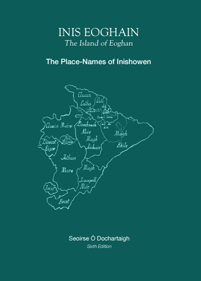
Place-Names of Inishowen (6th and final Edition) – Seoirse Ó Dochartaigh
THIS ACTUALLY IS THE FINAL EDITION!!!
It is full of new discoveries. Example: The hitherto nameless river at Redcastle has always been a mystery. Now it seems it was once called An Óige (The Youthful One). I base this on a 1610 reference to a place-name in Tullynavinn called Tevennyogea which I interpret as Taobh na hÓige (By the Side of the Youthful One). It divides Carrickmaquigley and Tullynavinn.
AND SO MUCH MORE!!!
Place-Names of Inishowen (5th and final Edition) – Seoirse Ó Dochartaigh
For this final 5th Edition, Seoirse discovered some fascinating Mariner’s Maps that date from 1776 and has reproduced extracts in the book. They are the equivalent of Google Satellite images showing, for one, what the Buncrana district looked like then: surprising, lots of tree-lined avenues. The houses depicted look quite substantial too – not a hint of Mica!
Many people already have previous editions of the place-names book so he doesn’t expect people to rush out and purchase this one but many who don’t have been asking for copies and he had run out of supply. This time Seoirse used a local printer, Foyle Press of Carndonagh, and they have done an excellent job with full-colour maps and photos. The format is the same but there was a good deal of fine-tuning involved plus an additional batch of previously unknown place-names.
Description
The Inishowen peninsula abounds in place-names, all steeped in history and legend, and all reflecting the flora and fauna of Donegal’s most beautiful province. These names celebrate both the macrocosm and microcosm of the landscape enshrined in every hillock, field, sea-cave and stream.
Since the 19th century – indeed since the first Inishowen map-makers of 1609 dipped their quills into ink – people have attempted a complete compendium of Inishowen place-names and their Gaelic origins. This book doesn’t claim to be the most forensic study to date but it is the first to cover the entire peninsula –from Urris to Templemore. Few are aware that four fifths of the parish of Templemore – now in Co. Derry – were once part of Inishowen and occupied a strategic location in the southern neck where the Gaelic O’Doherty chieftains built their most important castles and strongholds.
Seoirse Ó Dochartaigh is a lover of Gaelic culture and the Irish language which he has studied with dedication for over 4 decades. For several years now, he has been studying old maps and talking to many natives of the peninsula about the true origins and meanings of names of Inishowen townlands, mountains, rivers and hamlets. Though the work of collecting can never be truly finished until every stick, stone and nuance has been recorded and published, Ó Dochartaigh provided us with a rich harvest of colourful names, many of them published here for the first time. The author has, in effect, reversed the Anglicisation process that began in the 17th century and has even translated some English names back into indigenous Irish versions based on local ways of saying things and local ways of describing the landscape.
There is a plethora of maps here too– some very rare indeed – and historical sources used throughout the book indicate that many Inishowen place-names are more than 2000 years old – some even going back to the centuries BC and still in use today.
Seoirse Ó Dochartaigh’s book should not only stimulate local interest but should also tantalize the imagination of readers at home and abroad. This is a topographical odyssey.
